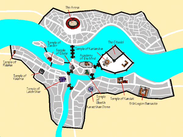
This is an old map of Filgeth I drew many years ago using Campaign Cartographer. For reasons which were probably to do with printing it out on an A4 page it’s rotated through 90 degrees – North is to the right, and west is at the top.
The west bank of the river (top part of the map) is the largely human-occupied part of the city, the east bank is the kandar side. The south-east quarter is the posh end.
